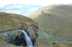
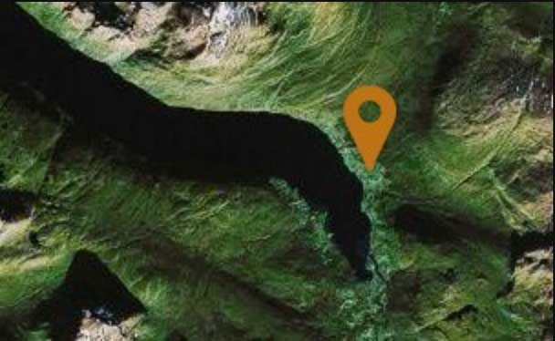
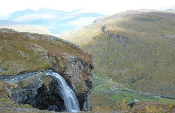
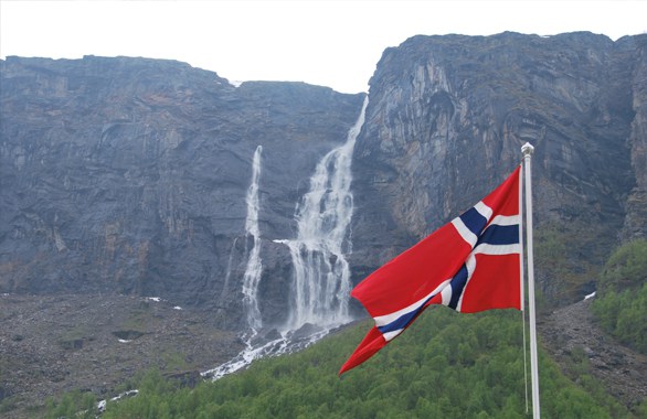
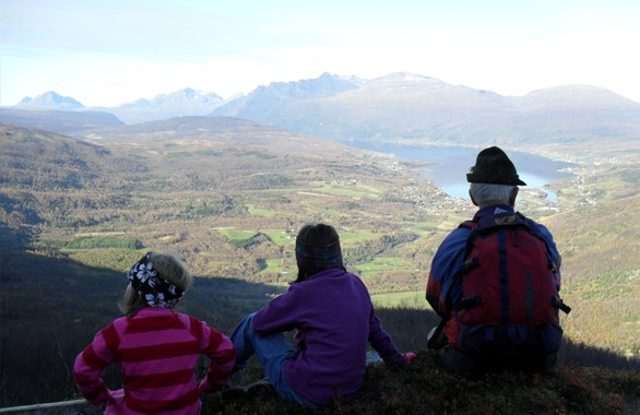
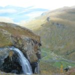
This is a easy hike, with the occasional steep hill and the hike is approximately 10 kilometers long. The first part of the hike is relatively flat and follows a road trough the woods, the rest of the way there is a trail that has a slightly higher curve. The end is where the waterfall goes over the edge, here you can see a beautiful view over spansdalen.
![mountains and waterfall](https://www.fjellkysten.no/wp-content/uploads/2017/05/henrikkafalls-hiking-waterfall-northern-norway-1.jpg)
![Norwegian flag with mountain in background](https://www.fjellkysten.no/wp-content/uploads/2017/05/henrikkafalls-hiking-waterfall-northern-norway-2.jpg)
![three people enjoying the view from a mountain](https://www.fjellkysten.no/wp-content/uploads/2017/05/henrikkafalls-hiking-waterfall-northern-norway-3.jpg)
![fossen3](https://www.fjellkysten.no/wp-content/uploads/2011/11/fossen3-1.jpg)
![fossen1](https://www.fjellkysten.no/wp-content/uploads/2011/11/fossen1-1.jpg)
![fossen2](https://www.fjellkysten.no/wp-content/uploads/2011/11/fossen2-1.jpg)
![mountains and waterfall](https://www.fjellkysten.no/wp-content/uploads/2017/05/henrikkafalls-hiking-waterfall-northern-norway-1-150x150.jpg)
![Norwegian flag with mountain in background](https://www.fjellkysten.no/wp-content/uploads/2017/05/henrikkafalls-hiking-waterfall-northern-norway-2-150x150.jpg)
![three people enjoying the view from a mountain](https://www.fjellkysten.no/wp-content/uploads/2017/05/henrikkafalls-hiking-waterfall-northern-norway-3-150x150.jpg)
![](https://www.fjellkysten.no/wp-content/uploads/2011/11/fossen3-1-150x150.jpg)
![](https://www.fjellkysten.no/wp-content/uploads/2011/11/fossen1-1-150x150.jpg)
![](https://www.fjellkysten.no/wp-content/uploads/2011/11/fossen2-1-150x150.jpg)
Henrikkafalls
PRACTICAL INFO
Difficulty
![](/wp-content/uploads/icons/Medium.png)